By car Parking: La Bannette, Thoard Distance: 21 km from Digne-les-Bains Time: around 30 mins
Prendre la N85 en direction de Sisteron / Aix-en-Provence. À Mallemoisson tourner à droite au feu tricolore et suivre la D17 jusqu'à Thoard. Sur la place du village de Thoard prendre à droite, juste après la fontaine publique, au niveau de l'indication GTPA (rouge / blanc). La route monte fortement en direction du lieu-dit de La Bannette (ferme-auberge). Se garer à l'auberge ou continuer sur la piste en galets pour se garer sur le parking signalé 100 m plus haut (Panneau de la Réserve Géologique).
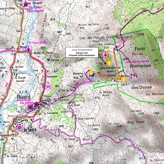
Hike Total time: 1 hr 20 mins Total distance: 3.3 km Net difference in altitude: 176 m Markings: (1)-(2), red and white; (2)-(3), no markings.
(1) From the car park, take the stony path, following the sign "Balade de Suy, carrière de gypse". There is a memorial on the right, a ruin on the left, then a lavender field. (2) At the far end of this field, go left along the path that leads to a rocky promontory surmounted by a television relay. (3) The Refuge d'Art – Chapelle Sainte-Madeleine can be seen lower down.
Return by the same route.
NB :all our GPS references are given in <.gpx> format. For files in formats such as <.trk>, <.grm> and <.kml>, you can do an automatic conversion by going to tracegps.com


 Parking: La Bannette, Thoard